Knowledge can’t be confined to books alone — it must be explored, practiced, and applied in real-world scenarios. Geographic Information Systems (GIS) is a dynamic, multidisciplinary field that empowers professionals with the tools and techniques to analyze spatial data and solve real-life challenges in environment, urban planning, disaster management, agriculture, forestry, and more. To master GIS, one must go beyond theoretical learning — it requires hands-on skills, technical understanding, and strategic thinking.
At Space Borne, we don’t just teach GIS — we build GIS professionals. Cracking into the world of geospatial analysis and remote sensing without structured guidance can be daunting. That’s why our training programs are designed not just to educate, but to empower. With a deep focus on practical learning, project-based exercises, and software proficiency, we offer our learners the edge they need in the geospatial job market.
While success has no shortcuts, Space Borne makes the journey smarter and faster. Our expert faculty, drawn from academic and industry backgrounds, equip learners with practical workflows, shortcuts, and deep insights that come only from real-world experience. But these tricks are only as good as the learner’s will to practice and perfect — and we make sure our students stay motivated and on track. At Space Borne, we believe in “Learning by Doing” — and we walk the talk every day.
Why is Space Borne the Best GIS Training Institute?
✅ Innovative Teaching Pedagogy – We blend lectures with real-world projects and live datasets.
📍 Pan-India Reach – Our online training and partnerships help learners across India and abroad.
🎯 Individual Attention – We understand that every learner is unique and requires focused mentorship.
❓ Dedicated Doubt Sessions – Regular Q&A slots to ensure no one lags behind.
📊 Result-Oriented Modules – We don’t just cover software, we ensure career-readiness.
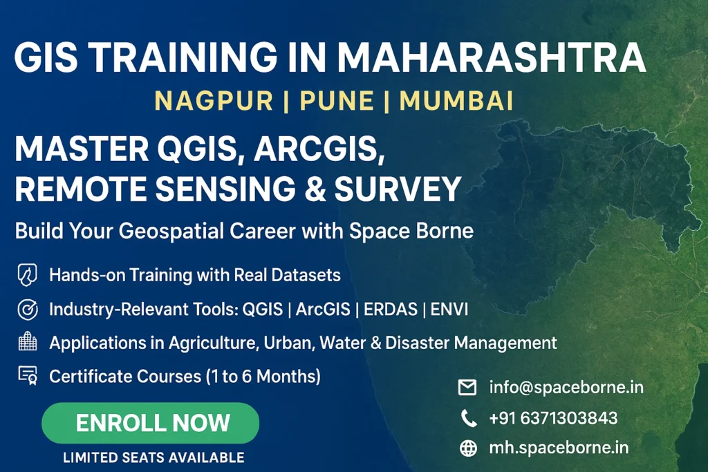
🧭 Updated, Industry-Aligned Curriculum – Based on current tools like QGIS, ArcGIS, ERDAS, Python, HEC-RAS, Drone Mapping, and more.
💻 Flexible Learning Modes – Online, hybrid, and offline options with access to class recordings.
👨🏫 Expert Mentors & Trainers – Our trainers are industry practitioners and researchers.
📲 Mobile App & LMS Support – Seamless access to classes, notes, and assignments on the go.
▶️ YouTube Channel for Regular Updates – Free video content and learning snippets.
📚 Extensive Study Material & Practice Tasks – Created by experts, updated regularly.
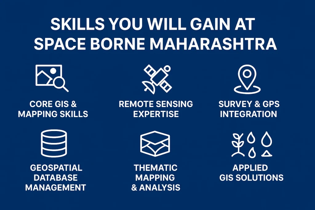
We don’t just teach GIS tools — we shape GIS thinkers. Our focus is on strengthening the core understanding of spatial concepts, data management, and geospatial modeling. From basic map creation to complex spatial analysis and AI-integrated remote sensing, Space Borne covers it all.
We mentor our learners for internships, job readiness, research careers, and higher studies. Our community continues to thrive with alumni working in reputed government and private institutions. We don’t just train — we transform careers.
Whether you’re a beginner stepping into the world of geospatial technology or a professional looking to upgrade your skills, Space Borne GIS Training Institute is your trusted partner.